
GEOL 207 Final, Spring 2000
American University of Beirut · Map Interpretation · 7 pages
More GEOL 207 files
Show the text of this final exam
American University of Beirut
Department of Geology
Geol 207 Map Interpretation
Final Exam
NAME: Spring 2000
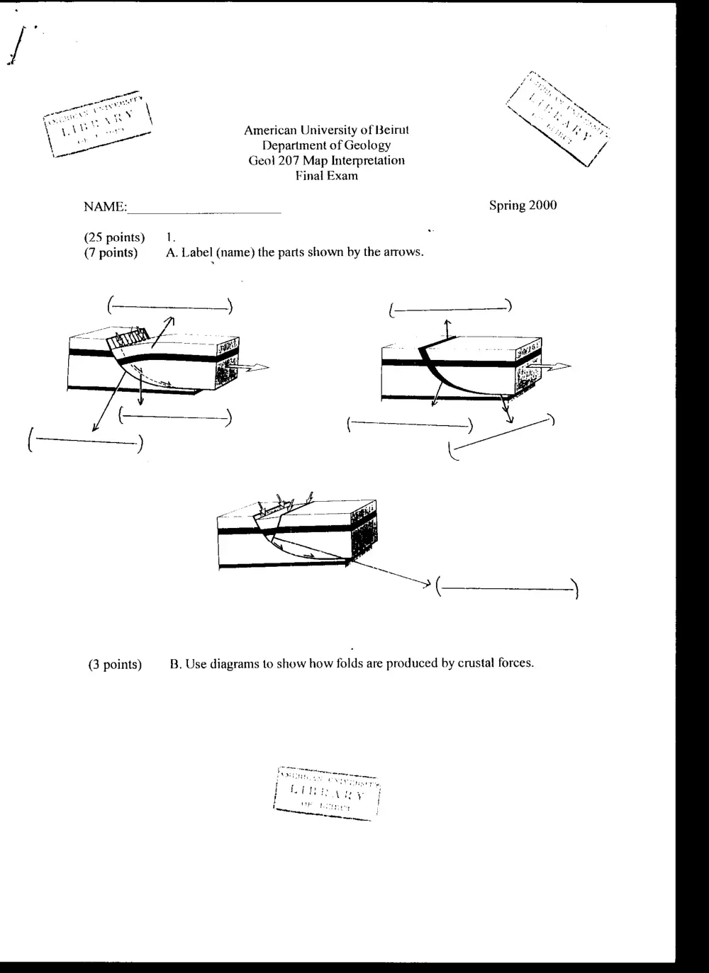
(25 points) — 1.
(7 points) A. Label (name) the parts shown by the arrows.
(3 points) B. Use diagrams to show how folds are produced by crustal forces.
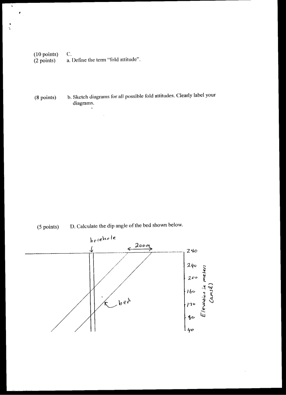
(10 points) = C.
(2 points) a. Define the term “fold attitude”.
b. Sketch diagrams for all possible fold attitudes. Clearly label your
diagrams.
(8 points)
(5 points) D. Calculate the dip angle of the bed shown below.
Loree le
4 = Aoom
Elevedien in meters
Cams£)
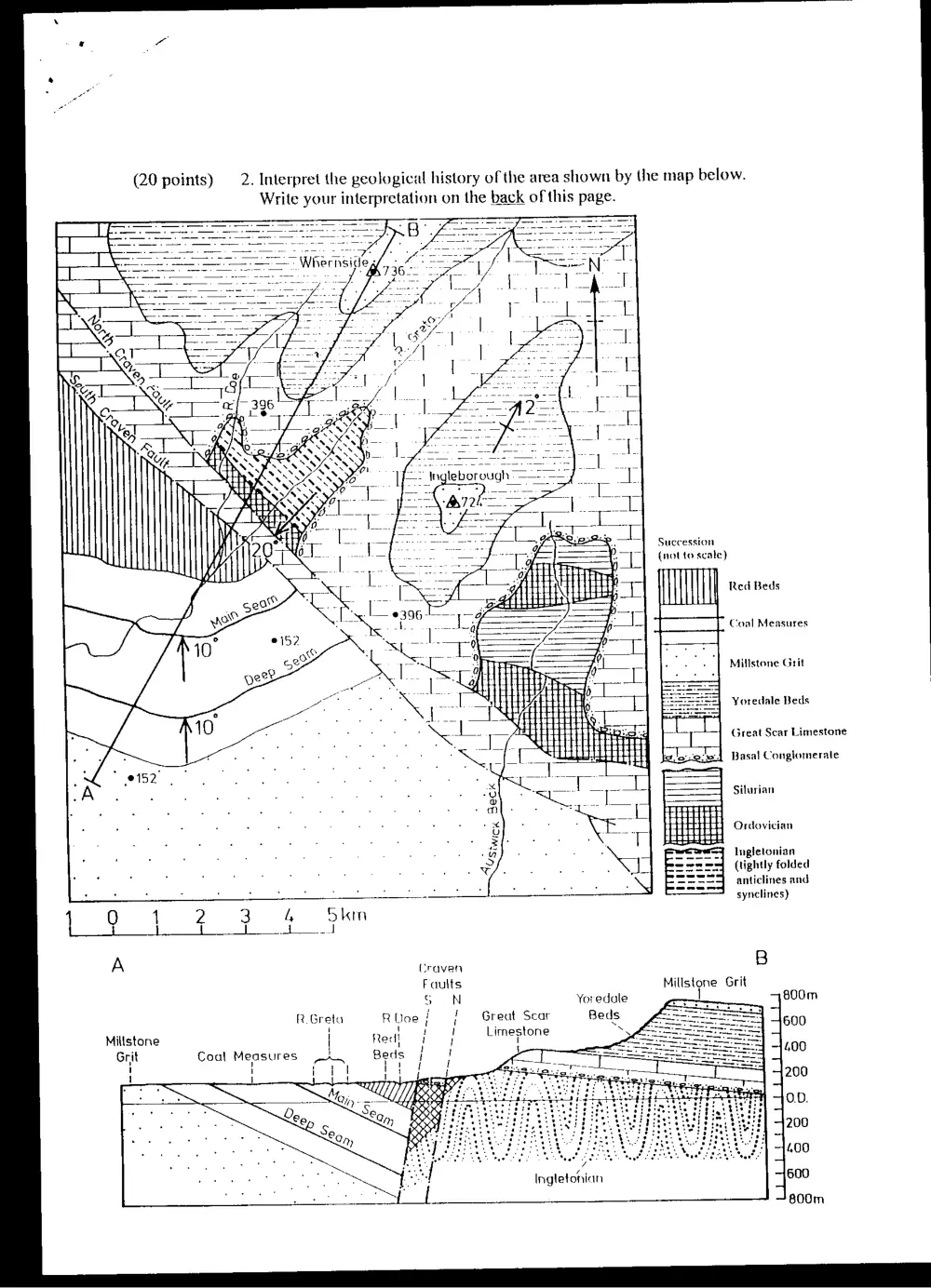
Write your interpretation on the back of this page.
(20 points) 2. Interpret the geological history of the area shown by the map below.
Succession
(not fo scale)
7
Red Beds
Coal Measures
Millstone Grit
: 152 _
Yoredale Beds
Great Scar Limestone
Basal Conglomerate
Silurian
i Ordovician
Ingletonian
(tightly folded
anticlines and
| QO 1 2 3 4 Skin
} | { J wt waned
A Craven
Faults
S oN Yoredale
R.Greta RUoe} } Great Scar Beds
Millstone | Red} ! Limestone .
\
Grit
1
!
Ingletonian
synclines)
B
Millstone Grit
| 800m
600
400
200
OD.
200
400
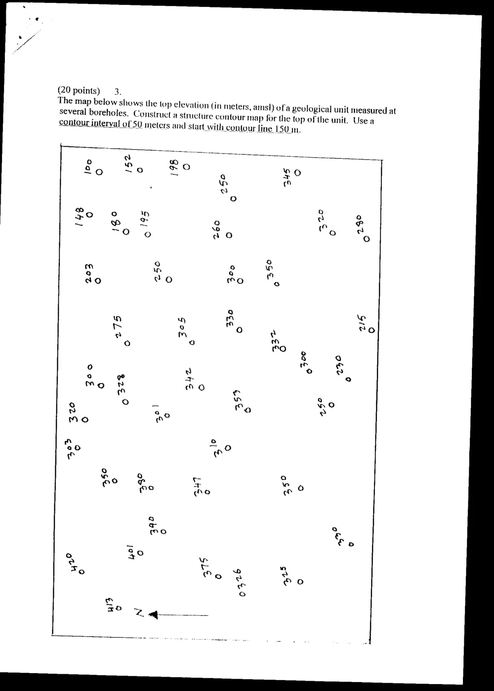
(20 points) 3.
The map below shows the top ele
several boreholes. Construct
contour interval of 50 meters
vation (in meters, amsl) ofa geological unit measured at
a structure contour map for the top of the unit. Use a
and start_with contour line 150m.
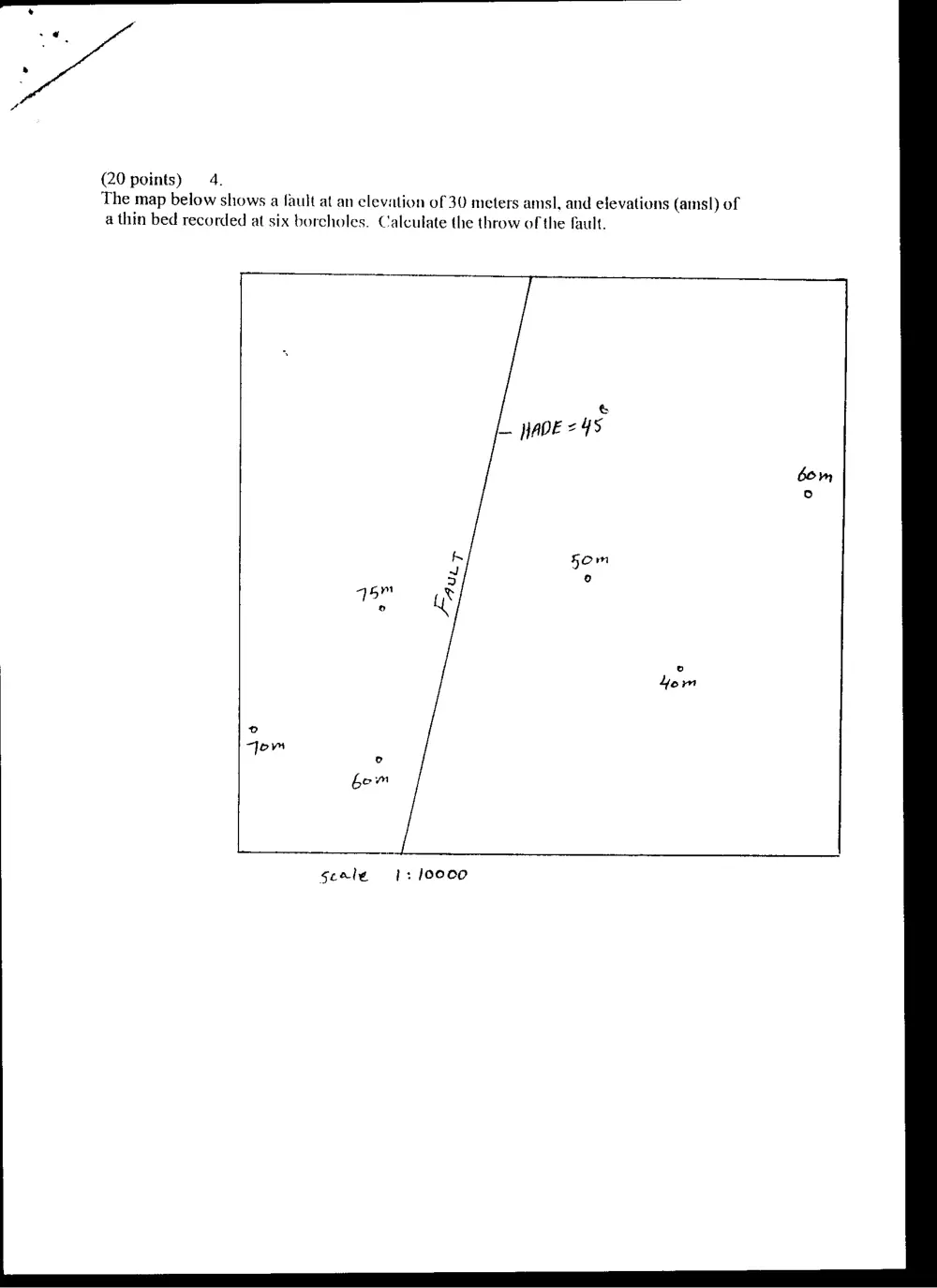
(20 points) 4.
The map below shows a fault at an clevation of 30 meters amsl, and elevations (amsl) of
a thin bed recorded at six borcholes. Calculate the throw of the fault.
&
_. WADE = 48
bom
o
K om
“Jom
bow
Seale 1: /00oco
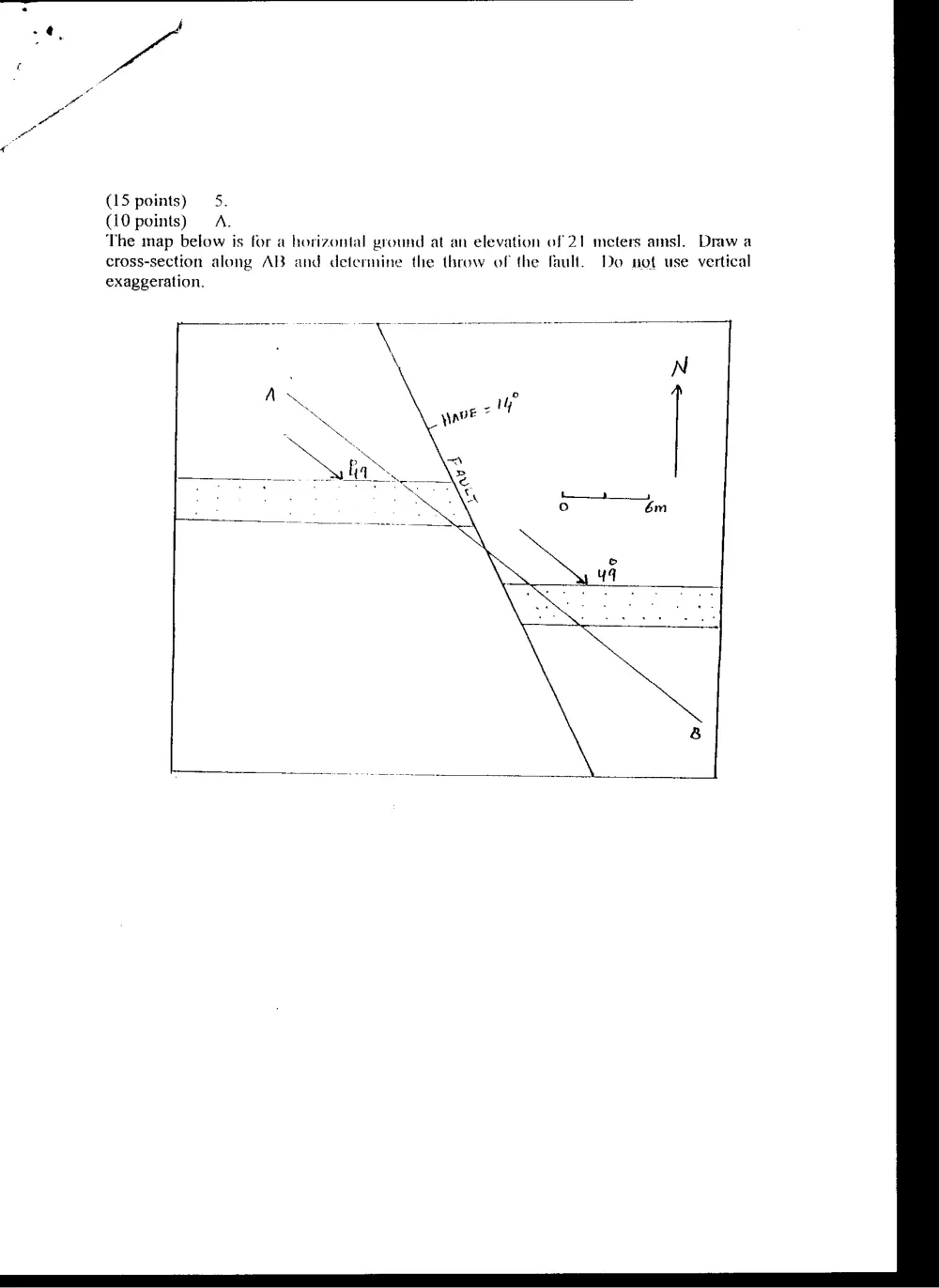
(15 points) 5.
(10 points) A.
The map below is for a horizontal ground at an elevation of 21 meters amsl. Draw a
cross-section along AB and determine the throw of the fault. Do not use vertical
exaggeration.
(5 points) B. Explain how an angular unconfomnity is formed. Support your answer
with diagrams.