
GEOL 225 Final, Spring 2000
American University of Beirut · Petroleum Geology · 3 pages
More GEOL 225 files
Show the text of this final exam
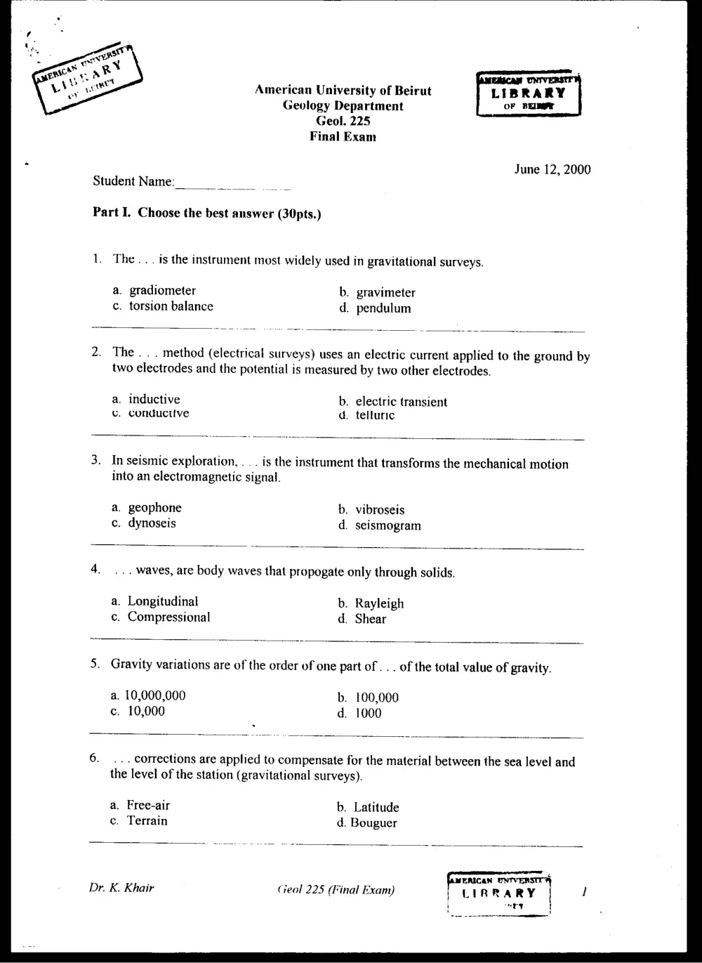
American University of Beirut LIBRARY
Geology Department OF BELAY
Geol. 225
Final Exam
June 12, 2000
Student Name:
Part I. Choose the best answer (30pts.)
1. The... is the instrument most widely used in gravitational surveys.
a. gradiometer b. gravimeter
c. torsion balance d. pendulum
2. The... method (electrical surveys) uses an electric current applied to the ground by
two electrodes and the potential is measured by two other electrodes.
a. inductive b. electric transient
&. conductive d. telluric
3. In seismic exploration, . . . is the instrument that transforms the mechanical motion
into an electromagnetic signal.
a. geophone b. vibroseis
c. dynoseis d. seismogram
4. ... waves, are body waves that propogate only through solids.
a. Longitudinal b. Rayleigh
c. Compressional d. Shear
5. Gravity variations are of the order of one part of . . . of the total value of gravity.
a. 10,000,000 b. 100,000
c. 10,000 d. 1000
6. ... corrections are applied to compensate for the material between the sea level and
the level of the station (gravitational surveys).
a. Free-air b. Latitude
ce. Terrain d. Bouguer
fisenican ONTVERSTO
Dr. K. Khair Ceol 225 (Final Exam) | 1
; LIRR ARY
i ry t
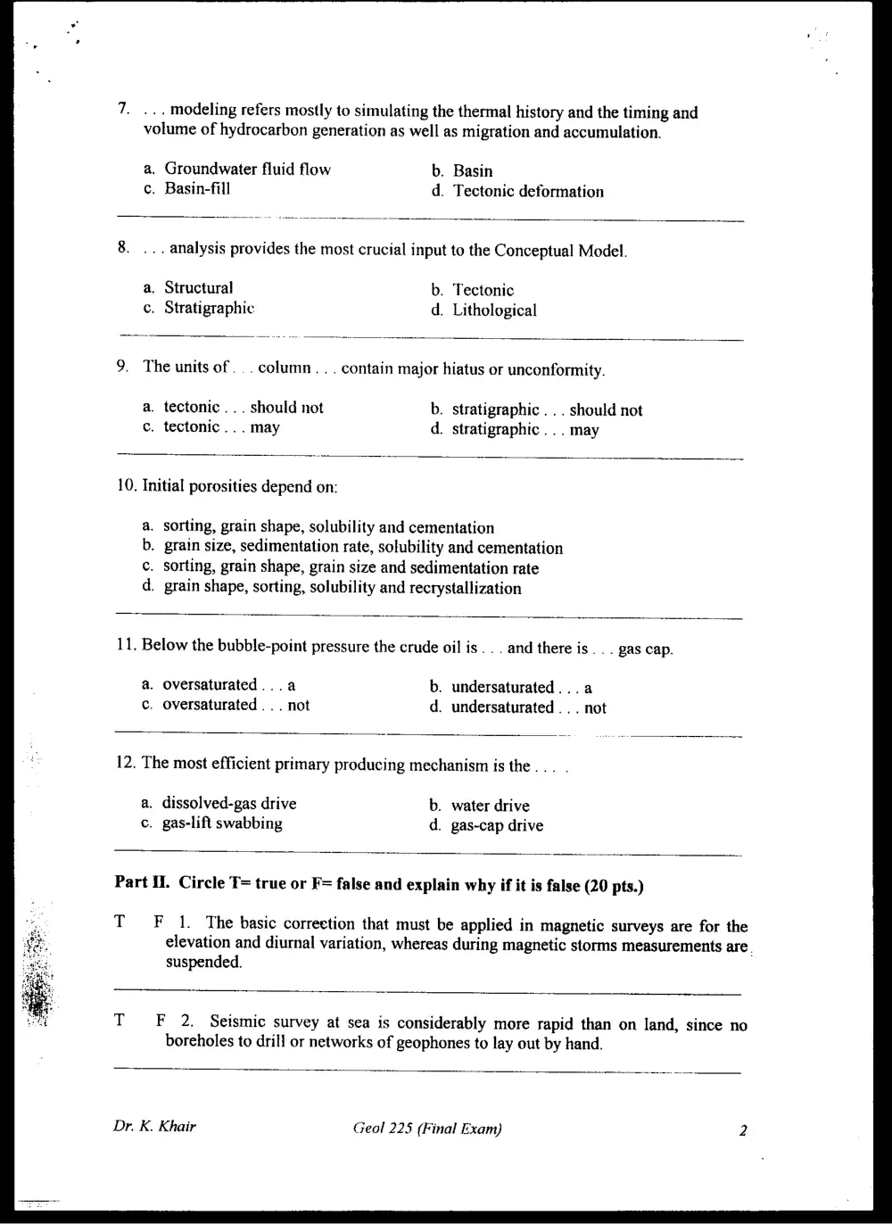
7. ... modeling refers mostly to simulating the thermal history and the timing and
volume of hydrocarbon generation as well as migration and accumulation.
a. Groundwater fluid flow b. Basin
c. Basin-fill d. Tectonic deformation
8. ... analysis provides the most crucial input to the Conceptual Model.
a. Structural b. Tectonic
c. Stratigraphic d. Lithological
9. The units of... column. . . contain major hiatus or unconformity.
a. tectonic... should not b. stratigraphic . . . should not
c. tectonic... may d. stratigraphic... may
10. Initial porosities depend on:
sorting, grain shape, solubility and cementation
grain size, sedimentation rate, solubility and cementation
sorting, grain shape, grain size and sedimentation rate
grain shape, sorting, solubility and recrystallization
aor p
11. Below the bubble-point pressure the crude oil is... and there is... gas cap.
a. oversaturated...a b. undersaturated... a
c. oversaturated ... not d. undersaturated .. . not
12. The most efficient primary producing mechanism is the... .
a, dissolved-gas drive b. water drive
c. gas-lift swabbing d. gas-cap drive
Part If. Circle T= true or F= false and explain why if it is false (20 pts.)
TF 1. The basic correction that must be applied in magnetic surveys are for the
elevation and diurnal variation, whereas during magnetic storms measurements are.
suspended.
TF 2. Seismic survey at sea is considerably more rapid than on land, since no
boreholes to drill or networks of geophones to lay out by hand.
Dr. K. Khair Geol 225 (Final Exam) 2
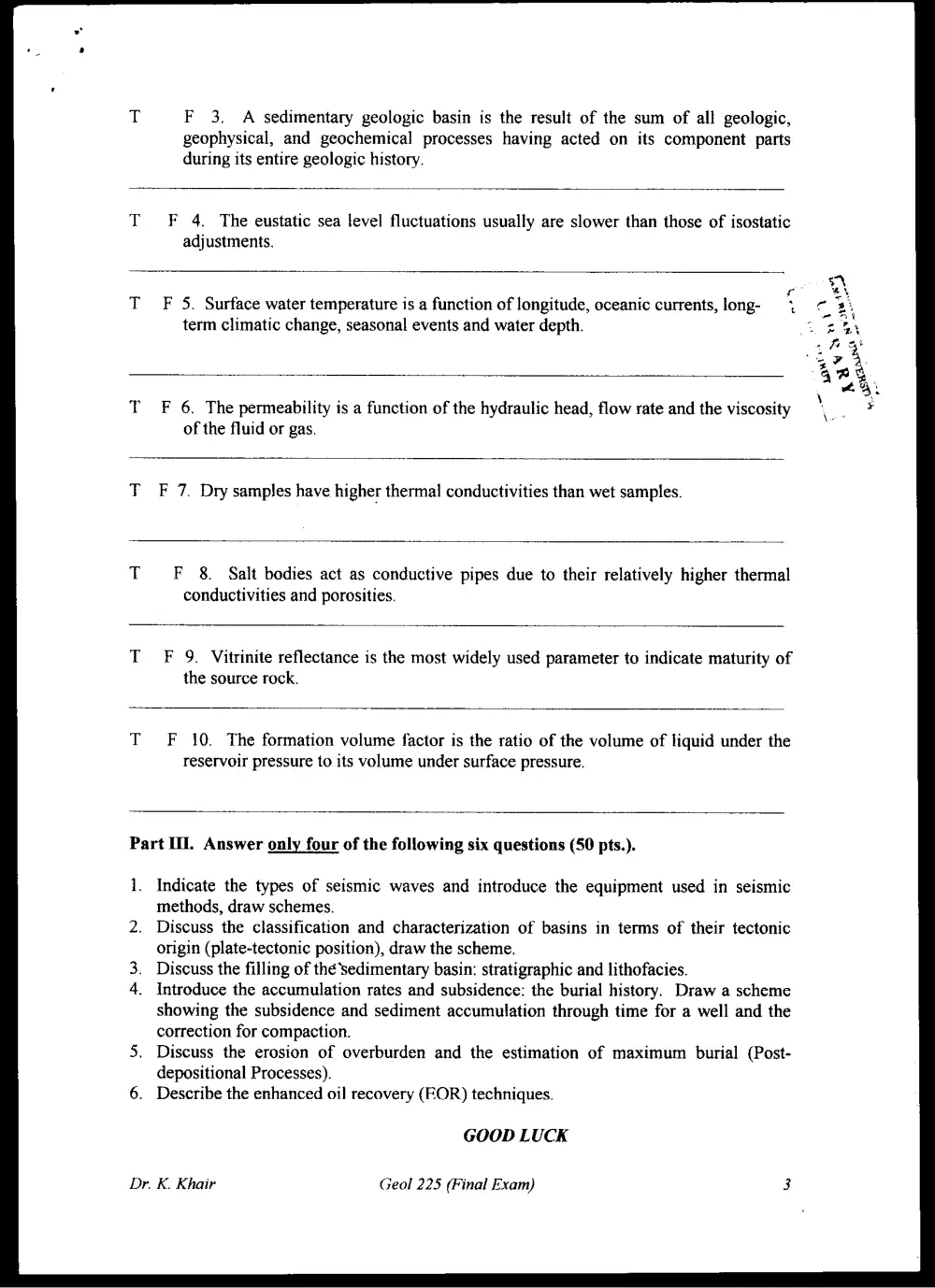
F 3. A sedimentary geologic basin is the result of the sum of all geologic,
geophysical, and geochemical processes having acted on its component parts
during its entire geologic history.
F 4. The eustatic sea level fluctuations usually are slower than those of isostatic
adjustments.
F 5. Surface water temperature is a function of longitude, oceanic currents, long-
term climatic change, seasonal events and water depth.
F 6. The permeability is a function of the hydraulic head, flow rate and the viscosity
of the fluid or gas.
F 7. Dry samples have higher thermal conductivities than wet samples.
F 8. Salt bodies act as conductive pipes due to their relatively higher thermal
conductivities and porosities.
F 9. Vitrinite reflectance is the most widely used parameter to indicate maturity of
the source rock.
F 10. The formation volume factor is the ratio of the volume of liquid under the
reservoir pressure to its volume under surface pressure.
Part II. Answer only four of the following six questions (50 pts.).
1. Indicate the types of seismic waves and introduce the equipment used in seismic
methods, draw schemes.
Discuss the classification and characterization of basins in terms of their tectonic
origin (plate-tectonic position), draw the scheme.
Discuss the filling of thé’sedimentary basin: stratigraphic and lithofacies.
Introduce the accumulation rates and subsidence: the burial history. Draw a scheme
showing the subsidence and sediment accumulation through time for a well and the
correction for compaction.
Discuss the erosion of overburden and the estimation of maximum burial (Post-
depositional Processes).
Describe the enhanced oil recovery (EOR) techniques.
GOOD LUCK
Dr. K. Khair Geol 225 (Final Exam)