
GEOL 210 Final, Fall 2005
American University of Beirut · Geomorphology · 6 pages
More GEOL 210 files
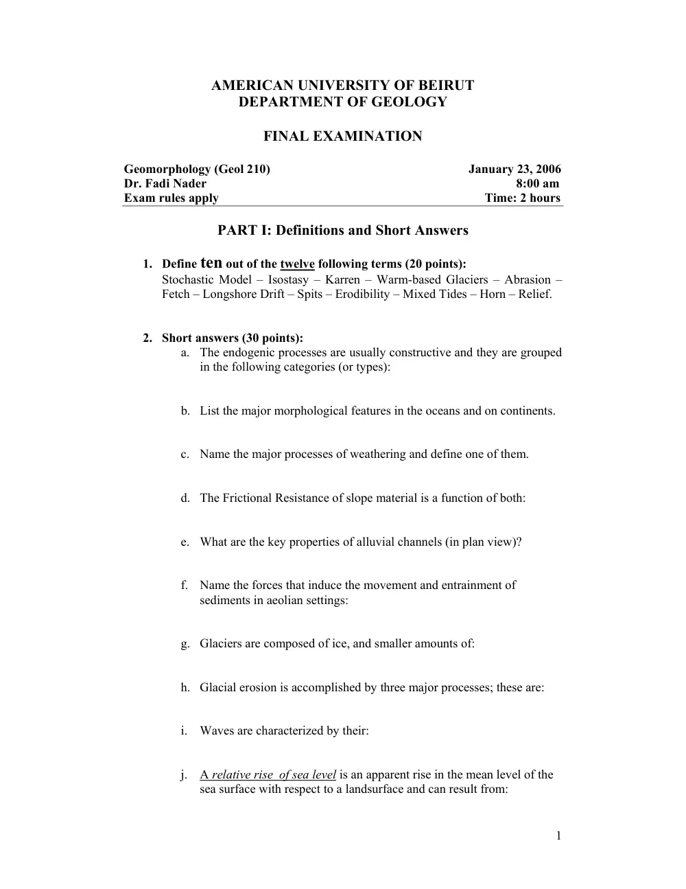
Show the text of this final exam
1
AMERICAN UNIVERSITY OF BEIRUT
DEPARTMENT OF GEOLOGY
FINAL EXAMINATION
Geomorphology (Geol 210)
January 23, 2006
Dr. Fadi Nader
8:00 am
Exam rules apply
Time: 2 hours
PART I: Definitions and Short Answers
1. Define ten out of the twelve following terms (20 points):
Stochastic Model – Isostasy – Karren – Warm-based Glaciers – Abrasion –
Fetch – Longshore Drift – Spits – Erodibility – Mixed Tides – Horn – Relief.
2. Short answers (30 points):
a. The endogenic processes are usually constructive and they are grouped
in the following categories (or types):
b. List the major morphological features in the oceans and on continents.
c. Name the major processes of weathering and define one of them.
d. The Frictional Resistance of slope material is a function of both:
e. What are the key properties of alluvial channels (in plan view)?
f. Name the forces that induce the movement and entrainment of
sediments in aeolian settings:
g. Glaciers are composed of ice, and smaller amounts of:
h. Glacial erosion is accomplished by three major processes; these are:
i. Waves are characterized by their:
j. A relative rise of sea level is an apparent rise in the mean level of the
sea surface with respect to a landsurface and can result from:
2
PART II: Diagrams and Short Discussions
3. Draw the ternary classification of coastal deltas and briefly define the
corresponding types of deltas (5 points).
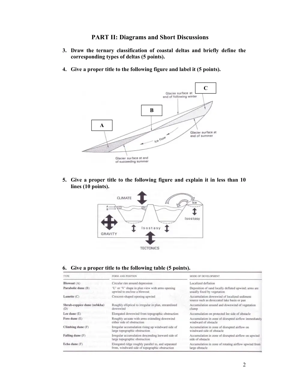
4. Give a proper title to the following figure and label it (5 points).
5. Give a proper title to the following figure and explain it in less than 10
lines (10 points).
6. Give a proper title to the following table (5 points).
A
B
C
3
PART III: Discussion
7. Answer one of the two following questions (25points):
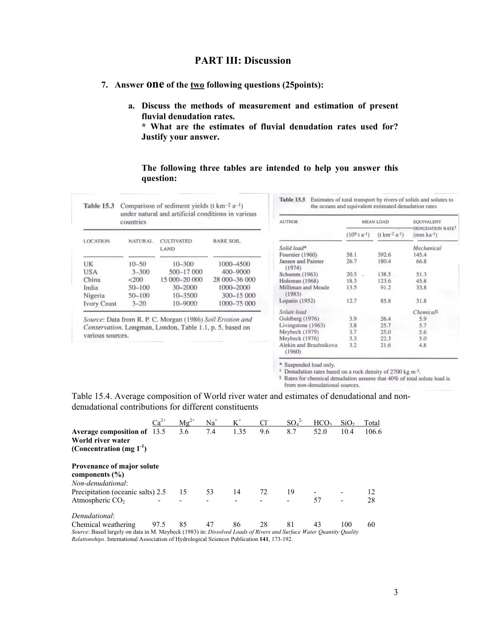
a. Discuss the methods of measurement and estimation of present
fluvial denudation rates.
* What are the estimates of fluvial denudation rates used for?
Justify your answer.
The following three tables are intended to help you answer this
question:
Table 15.4. Average composition of World river water and estimates of denudational and non-
denudational contributions for different constituents
Ca2+
Mg2+
Na+
K+
Cl-
SO4
2-
HCO3
SiO2 Total
Average composition of 13.5
3.6
7.4
1.35
9.6
8.7
52.0
10.4 106.6
World river water
(Concentration (mg 1-1)
Provenance of major solute
components (%)
Non-denudational:
Precipitation (oceanic salts) 2.5
15
53
14
72
19
-
-
12
Atmospheric CO2
-
-
-
-
-
-
57
-
28
Denudational:
Chemical weathering
97.5
85
47
86
28
81
43
100
60
Source: Based largely on data in M. Meybeck (1983) in: Dissolved Loads of Rivers and Surface Water Quantity Quality
Relationships. International Association of Hydrological Sciences Publication 141, 173-192.
4
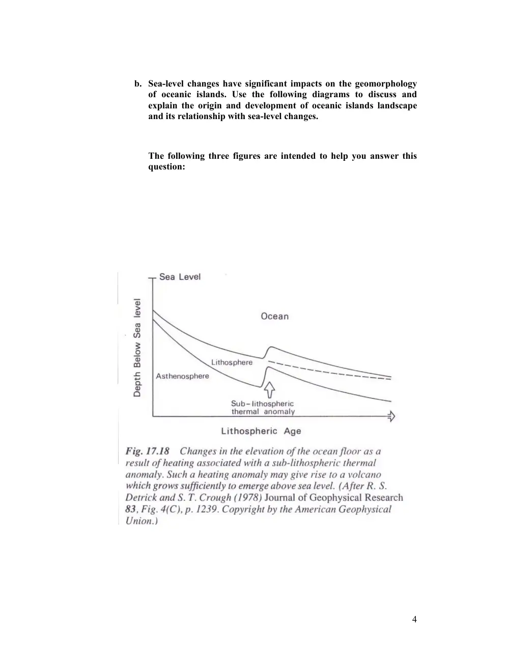
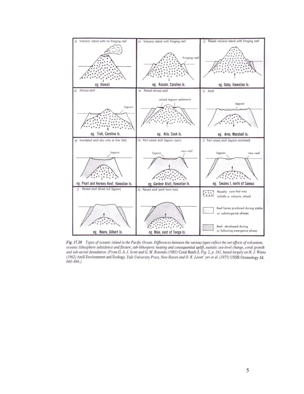
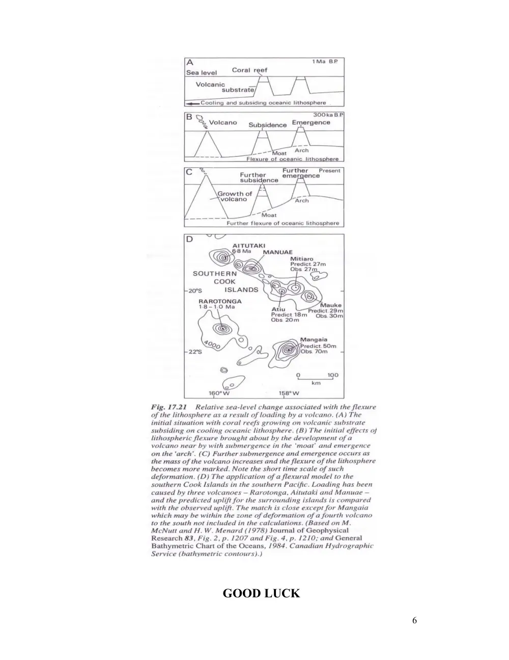
b. Sea-level changes have significant impacts on the geomorphology
of oceanic islands. Use the following diagrams to discuss and
explain the origin and development of oceanic islands landscape
and its relationship with sea-level changes.
The following three figures are intended to help you answer this
question:
5
6
GOOD LUCK