
GEOL 201 Final, Spring 1998
American University of Beirut · Physical Geology · 7 pages


More GEOL 201 files
Show the text of this final exam
American University of Beirut
Geology Department
Geology 201
Final Exam
June 22, 1998
Student Name:
POLICY ON THE EXAM
Leave all your belongings (except for pens) far from your place.
Be silent, don't look to the sides.
Read the questions carefully before answering.
Anyone found cheating will have their paper confiscated.
Make your answers clear (confused answers will not be considered).
There is no penalty in the first three parts, and concerning parts 1V and V_ answer only two questions of
each part.
Au bwnr
THANK YOU FOR YOUR COOPERATION
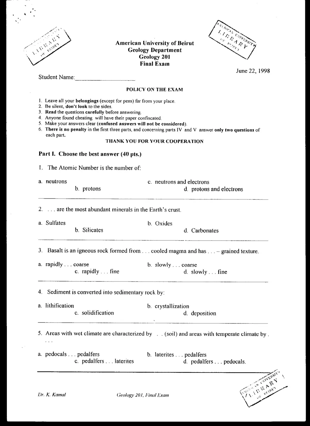
Part I. Choose the best answer (40 pts.)
1. The Atomic Number is the number of:
a. neutrons c. neutrons and electrons
b. protons d. protons and electrons
2. ... are the most abundant minerals in the Earth’s crust.
a. Sulfates b. Oxides
b. Silicates d. Carbonates
3. Basalt is an igneous rock formed from. . . cooled magma and has . . . — grained texture.
a. rapidly... coarse b. slowly... coarse
c. rapidly... fine d. slowly... fine
4. Sediment is converted into sedimentary rock by:
a. lithification b. crystallization
c. solidification d. deposition
5. Areas with wet climate are characterized by . . (soil) and areas with temperate climate by .
a. pedocals... pedalfers b. laterites ... pedalfers
c. pedalfers.. . laterites d. pedalfers ... pedocals.
Ke
. PAS \
— e>
ee a ee
Cate at
Dr. K. Kamal Geology 201, Final Exam \ \ ae
6. Chemical weathering increases as we move from ....
a. Florida (wet), Arizona (dry) to Arctic regions
b. Arizona, Arctic regions to Florida
c. Arctic regions, Arizona to Florida
d. Arctic regions, Florida to Arizona
7... . is a series of rock layers that everywhere has about the same physical properties and
contains the same assemblage of fossils.
a. Formation b. Series
c. System d. Stage
8. The units of Geologic Time scale, from largest to smallest are:
a. eons, periods, eras, epochs b. eras, periods, eons, epochs
c. periods, epochs, eras, eons d. eons, eras, periods, epochs
9. ... are flowing masses of material mostly finer than sand with large amount of water.
a. Earthflows b. Debris flows
c. Mudflows d. Solifluction
10. ... is the slowest unconsolidated mass wasting, with a rate of movement ranging between .
a. Slump... 1-10 mm/year b. Creep... 1-10 mm/year
c. Slump... 1-10 m/day d. Creep... 1-10 m/day
11. The water frozen in glaciers makes up about. . . % of the Hydrosphere.
a. 20 b. 7
c. 3 dt.
12. Potable water should be agreeable to taste and not dangerous to health and typically
containing... ppm of TDS.
a. 1800 b. 1250
c. 650 d. 150
13.... or... waves are transmitted only through solids.
a. S... shear b. P... shear
c. S... compressional d. P... compressional
Dr. K. Kamal Geology 201, Final Exam 2
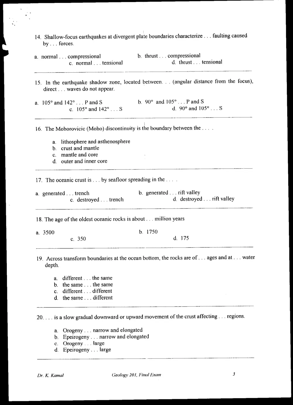
14. Shallow-focus earthquakes at divergent plate boundaries characterize . . . faulting caused
by... forces.
a. normal .. . compressional b. thrust... compressional
c. normal . . . tensional d. thrust... tensional
15. In the earthquake shadow zone, located between. . . (angular distance from the focus),
direct . .. waves do not appear.
a. 105° and 142°... PandS b. 90° and 105°... PandS
c. 105° and 142°...5 d. 90° and 105°...S
16. The Mohorovicic (Moho) discontinuity is the boundary between the... .
lithosphere and asthenosphere
crust and mantle
mantle and core
outer and inner core
ao oP
17. The oceanic crust is... by seafloor spreading in the... .
a. generated... trench b. generated . . . rift valley
c. destroyed... trench d. destroyed... rift valley
18. The age of the oldest oceanic rocks is about . .. million years
a. 3500 b. 1750
c. 350 d. 175
19. Across transform boundaries at the ocean bottom, the rocks are of... ages and at... water
depth.
a. different... the same
b. the same... the same
c. different... different
d. the same... different
20... . is a slow gradual downward or upward movement of the crust affecting . . . regions.
a. Orogeny... narrow and elongated
b. Epeirogeny . . . narrow and elongated
c. Orogeny .. . large
d. Epeirogeny .. . large
Dr. K. Kamal Geology 201, Final Exam 3
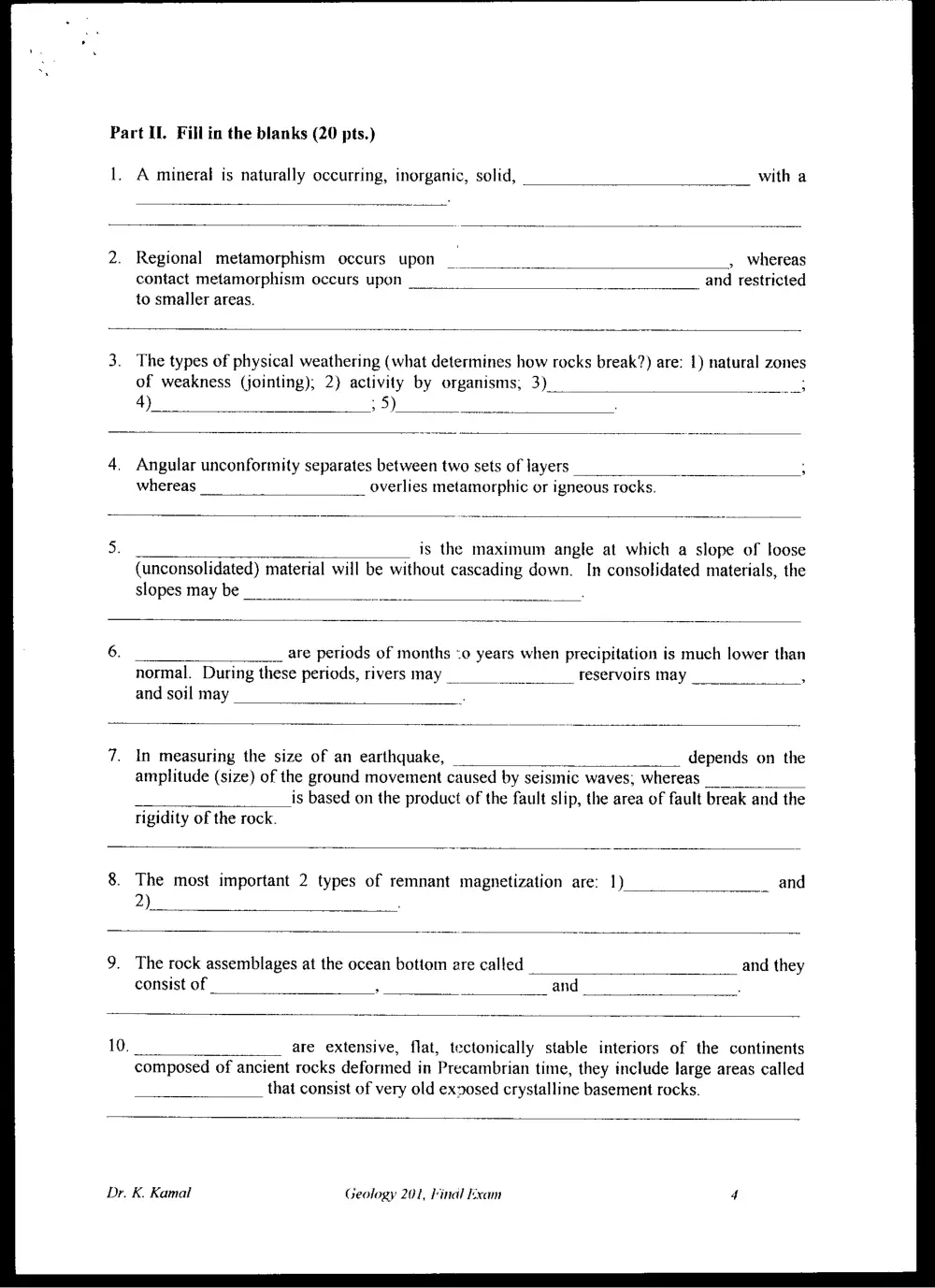
Part IL. Fill in the blanks (20 pts.)
1. A mineral is naturally occurring, inorganic, solid,
Regional metamorphism occurs upon —__ , whereas
contact metamorphism occurs upon 7 and restricted
to smaller areas.
The types of physical weathering (what determines how rocks break?) are: 1) natural zones
of weakness (jointing); 2) activity by organisms, 3) _ eG
4) ; 5)
Angular unconfortnity separates between two sets of layers
whereas overlies metamorphic or igneous rocks.
is the maximum angle at which a slope of loose
(unconsolidated) material will be without cascading down. In consolidated materials, the
slopes may be _
__ are periods of months <o years when precipitation is much lower than
normal. During these periods, rivers may reservoirs may ;
and soil may
In measuring the size of an earthquake, _ _ depends on the
amplitude (size) of the ground movement caused by seismic waves, whereas _
is based on the product of the fault slip, the area of fault break and the
rigidity of the rock.
The most important 2 types of remnant magnetization are: 1)
2)
The rock assemblages at the ocean bottom are called and they
consist of : and
are extensive, flat, tectonically stable interiors of the continents
composed of ancient rocks deformed in Precambrian time, they include large areas called
that consist of very old exnosed crystalline basement rocks.
Dr. K. Kamal Geology 201, Final Exam
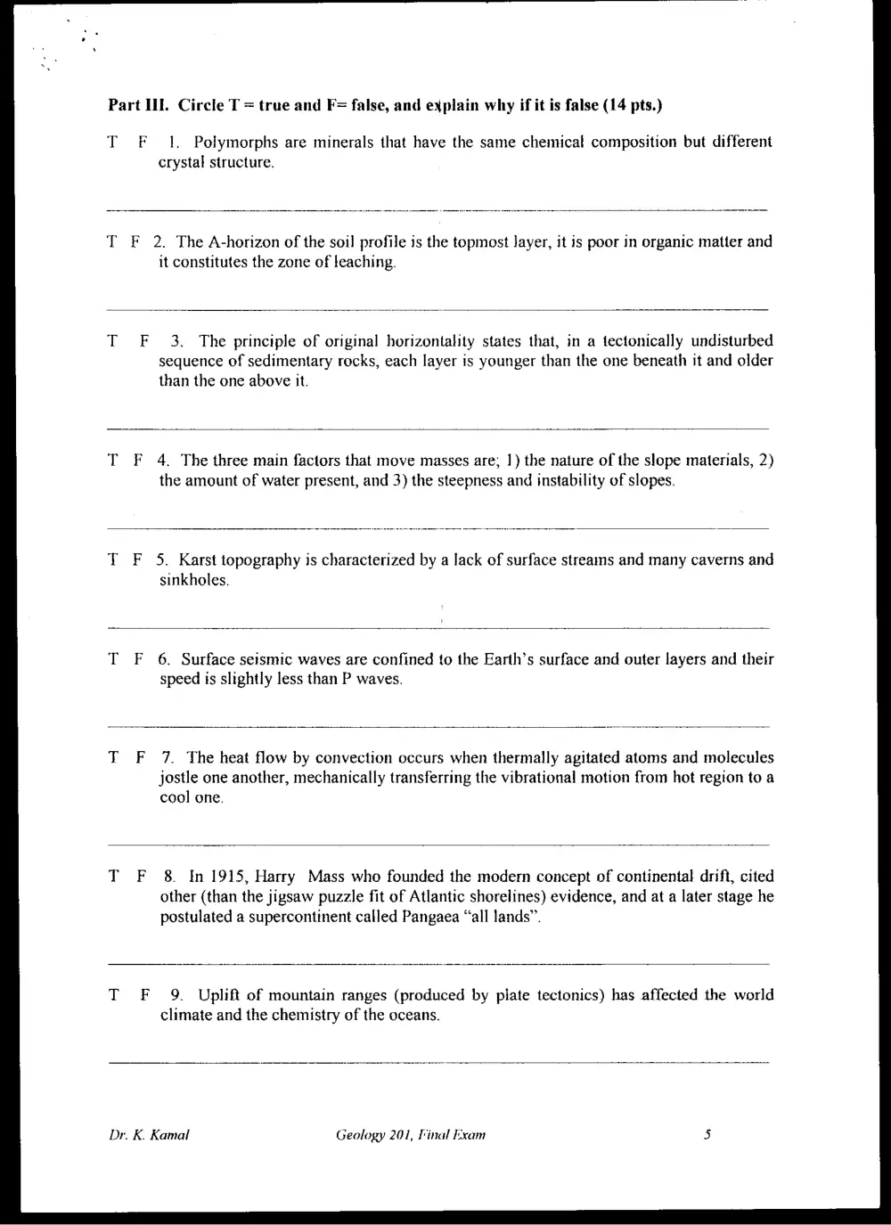
Part ILI. Circle T = true and F= false, and explain why if it is false (14 pts.)
T F 1. Polymorphs are minerals that have the same chemical composition but different
crystal structure.
T F 2. The A-horizon of the soil profile is the topmost layer, it is poor in organic matter and
it constitutes the zone of leaching.
F 3. The principle of original horizontality states that, in a tectonically undisturbed
sequence of sedimentary rocks, each layer is younger than the one beneath it and older
than the one above it.
F 4, The three main factors that move masses are; 1) the nature of the slope materials, 2)
the amount of water present, and 3) the steepness and instability of slopes.
F 5. Karst topography is characterized by a lack of surface streams and many caverns and
sinkholes.
F 6. Surface seismic waves are confined to the Earth’s surface and outer layers and their
speed is slightly less than P waves.
F 7. The heat flow by convection occurs when thermally agitated atoms and molecules
jostle one another, mechanically transferring the vibrational motion from hot region to a
cool one.
F 8. In 1915, Harry Mass who founded the modern concept of continental drift, cited
other (than the jigsaw puzzle fit of Atlantic shorelines) evidence, and at a later stage he
postulated a supercontinent called Pangaea “all lands”.
F 9. Uplift of mountain ranges (produced by plate tectonics) has affected the world
climate and the chemistry of the oceans.
Dr. K. Kamal Geology 201, Final Exam
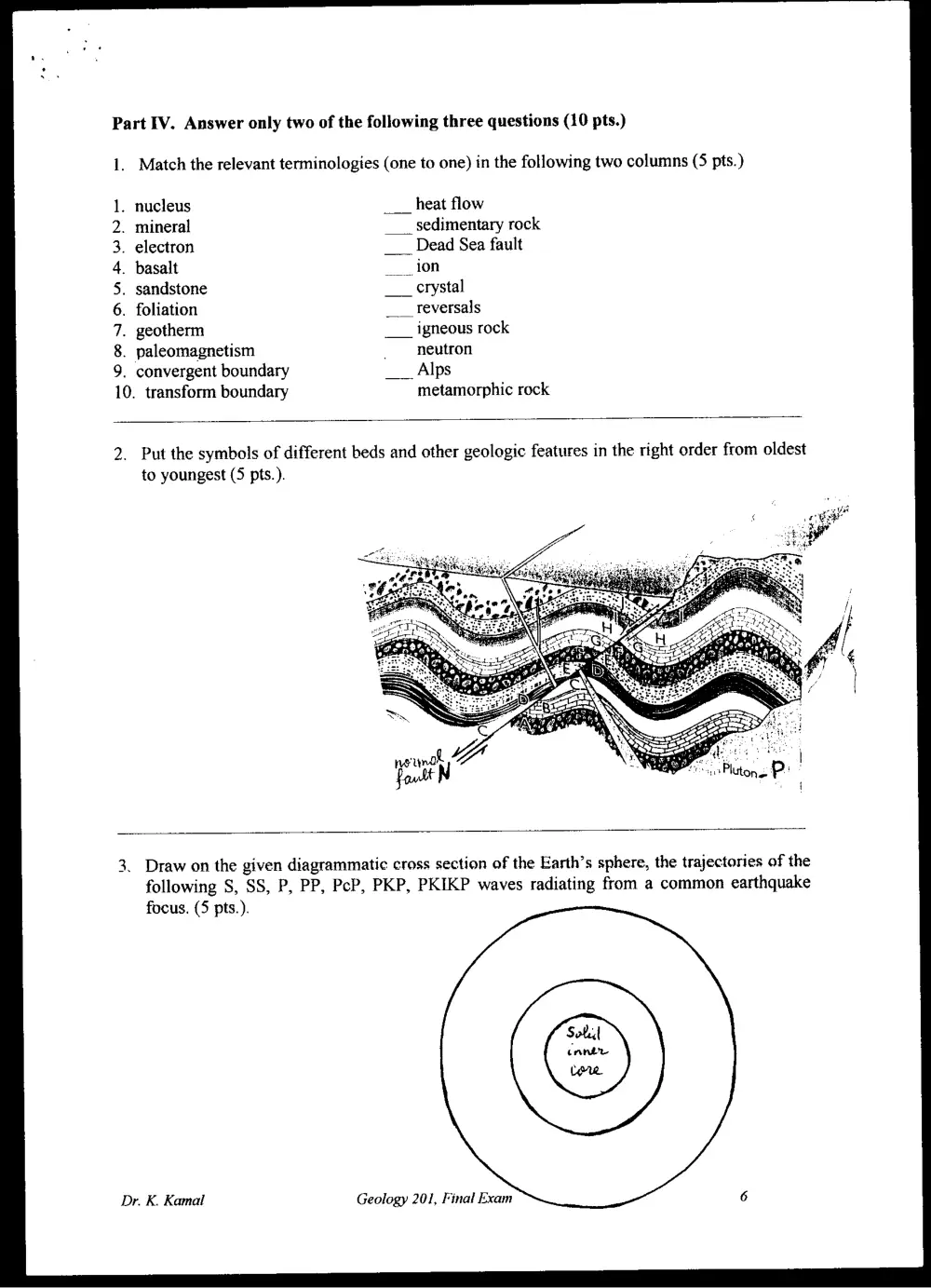
Part IV. Answer only two of the following three questions (10 pts.)
1. Match the relevant terminologies (one to one) in the following two columns (5 pts.)
1. nucleus ___ heat flow
2. mineral ___ sedimentary rock
3. electron ___ Dead Sea fault
4. basalt i
5. sandstone
6. foliation ___ reversals
7. geotherm ___ igneous rock
8. paleomagnetism _ neutron
9. convergent boundary ___ Alps
1
0. transform boundary metamorphic rock
2. Put the symbols of different beds and other geologic features in the right order from oldest
to youngest (5 pts.).
3. Draw on the given diagrammatic cross section of the Earth’s sphere, the trajectories of the
following S, SS, P, PP, PcP, PKP, PKIKP waves radiating from a common earthquake
focus. (5 pts.).
Dr. K. Kamal Geology 201, Final Exam
Part V. Answer only two of the following three questions (16 pts.)
1. Draw the scheme of the rock cycle as it is given in the textbook.
2. Define the seismograph and explain how the earthquake epicenter is located, draw
schemes.
3. Discuss the microplate terranes and plate tectonics, give some examples.
GOOD LUCK
Dr. K. Kamal Geology 201, Final kxam 7